
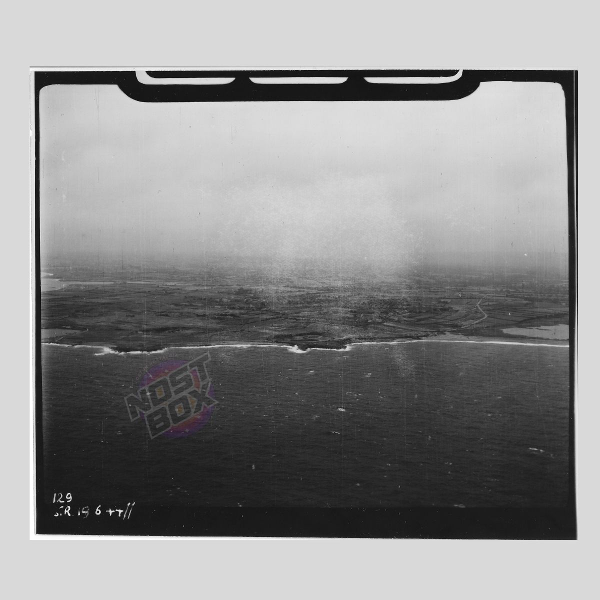
RAF Reconnaissance Photograph – Normandy Coastline (Frame 129 – 19 June 1944)
£34.99
1 in stock
Description
RAF Reconnaissance Photograph – Normandy Coastline (Frame 129 – 19 June 1944)
📸 Item: Original RAF Air Ministry Reconnaissance Photograph
📅 Date: 19 June 1944 (D+13)
📍 Location: Normandy coastline, France
🛩 Mission Type: Coastal survey & post–D-Day monitoring
📏 Size: 13cm x 11cm
Condition:
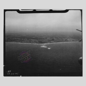
Light operational wear with minor exposure wash on the centre. Camera-port framing visible at the top. Strong detail across the surf line, farmland, and inland road network.
Markings:
Handwritten sortie notations read “129 S.R. 19 6 44 II” identifying this as Frame 129 of a Special Reconnaissance run flown on 19 June 1944.
Description:
A genuine RAF reconnaissance photograph capturing a section of the Normandy coast just 13 days after D-Day. The plate shows rugged coastline, inland fields, and road lines likely monitored for German vehicle movement and supply traffic. Part of the same sortie as the lighthouse photograph (Frame 130), making it a valuable sequential plate for collectors of early post-invasion aerial intelligence.
Related products
-
RAF Reconnaissance Photograph – Loaded LCT Wreck with Jeep On Deck (WWII D-Day Coastal Intel)
£79.99 -
RAF Reconnaissance Photograph – Goury / Cap de la Hague Lighthouse – June 1944 Aerial Intel
£69.99 -
RAF Recon Photo – Lorient U-Boat Base Approach (La Perrière Lock), 1944 – Original Air Ministry Print
£99.99 -
RAF Reconnaissance Photograph – Coastal Impact & Shoreline Intel (Frame 127 – 19 June 1944)
£49.99
Reviews
There are no reviews yet.